
Usòrò:El-Atteuf Ghardaia Algeria.jpg
Otu nyochaa a ha:800 × 600 piksels Ndị ọzọ mkpebi:320 × 240 piksels | 640 × 480 piksels | 1,024 × 768 piksels | 1,280 × 960 piksels | 1,600 × 1,200 piksels.
Failụ si na nke mbu (1,600 × 1,200 pixel, ívù akwukwo orunótu: 272 KB, MIME nke: image/jpeg)
Mmẹkụwátá
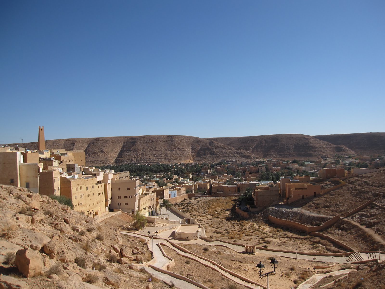
| Nkówá | El-Atteuf, the oldest of the five valley towns, founded in 1013 |
| Ǹgụ́ụ̀bọ̀chị̀ | |
| Mkpọlọ́gwụ̀ | Algeria Tunisia Libya 007 |
| Odé ákwụ́kwọ́ | Stefan Krasowski from New York, NY, USA |
| Nke ya ozor |

| Camera location | | View this and other nearby images on: OpenStreetMap |
|---|
Nkwényé
Usòrò nke á di okpúrù ákwúkwó íwú nke Mmẹ Òkike Tu ụta Ñkịtị édé íwú nke Í kpó áhà nke Ñkịtị 2.0.
- I wepulara nóru:
- i nye – ikọpị,ikekasi na izịpụ ọru a
- i dowaria – igbanwee ọrụ a
- Ọ ga bụ na ọnọdụ ndi a:
- í-kpó-áhà – Ị ga-enyerịrị ugo kwesịrị ekwesị, nye njikọ na ikikere ahụ, ma gosikwa ma emere mgbanwe. Ị nwere ike ime ya n'ụzọ ezi uche ọ bụla, mana ọ bụghị n'ụzọ ọ bụla na-egosi na onye nyere ikikere kwadoro gị maọbụ ojiji gị.
| This image was originally posted to Flickr by rapidtravelchai at https://www.flickr.com/photos/65638600@N05/6089386924. It was reviewed on 9 Julaị 2012 by FlickreviewR and was confirmed to be licensed under the terms of the cc-by-2.0. |
|
According to article 50 of the Algerian copyright law, it shall be lawful to reproduce or to communicate to the public, without authorization of the author and without remuneration, a work of architecture or the fine arts, a work of applied arts or a photographic work that is permanently situated in a public place, with the exception of art galleries, museums and classified cultural or natural sites.
See COM:CRT/Algeria#Freedom of panorama for more information.
|
Ịta nke usòrò
Bìri èhì/ogè k'ị hụ òtù ụ̀fa dị̀ m̀gbè ahụ̀.
| Èhì/Ogè | Mbọ-aka | Ógólógó na asaá | Òjìème | Nkwute | |
|---|---|---|---|---|---|
| dị ùgbu â | 18:37, 9 Julaị 2012 | | 1,600 × 1,200 (272 KB) | Dzlinker | == {{int:filedesc}} == {{Information |Description=El-Atteuf, the oldest of the five valley towns, founded in 1013 Rapid Travel Chai Travel fast and smart...linger only in memories [http://rapidtravelchai.com rapidtravelchai.com] |Source=[http://www.fl... |
Ojiji faịlụ
Ihe ndị na-eso ihe eji Ihu akwụkwọ eme na faịlụ a:
Ejiji failụ zụrụ ọha
Wikis ndi a edeputara na eji kwa failụ a:
- Ihe eji na ar.wikipedia.org
- Ihe eji na arz.wikipedia.org
- Ihe eji na azb.wikipedia.org
- Ihe eji na de.wikipedia.org
- Ihe eji na en.wikipedia.org
- Ihe eji na es.wikipedia.org
- Ihe eji na fa.wikipedia.org
- Ihe eji na fr.wikipedia.org
- Ihe eji na ha.wikipedia.org
- Ihe eji na id.wikipedia.org
- Ihe eji na it.wikipedia.org
- Ihe eji na it.wikivoyage.org
- Ihe eji na nl.wikipedia.org
- Ihe eji na pt.wikipedia.org
- Ihe eji na ro.wikipedia.org
- Ihe eji na sl.wikipedia.org
- Ihe eji na sw.wikipedia.org
- Ihe eji na ts.wikipedia.org
- Ihe eji na tum.wikipedia.org
- Ihe eji na vec.wikipedia.org
- Ihe eji na vi.wikipedia.org
- Ihe eji na www.wikidata.org
- Ihe eji na yo.wikipedia.org
- Ihe eji na zh.wikipedia.org
- Ihe eji na zu.wikipedia.org