Jump to content

Faịlụ:North America second level political division 2.svg

Page contents not supported in other languages.
Shí Wikipedia, njikotá édémédé nke onyobulạ

Failụ si na nke mbu (usòrò SVG, nà áhà pixel 512 × 596, ívụ usòrò: 132 KB)

Failụ a si na Wikimedia Commons,enwekwara ike iji ya eme ihe na arụmarụ ọzọ. Nkọwa na ihuakwukwọ nkọwa failụ eziri na okpuru.

Mmẹkụwátá

Nkówá
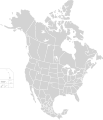
English: Map of North America and its second-level political divisions. Canadian provinces, US and Mexican states. Canada, Mexico, United States.

Non-contiguous parts of a states/provinces are "grouped" together with the main area of the state/provinces, so any state/provinces can be coloured in completion with one click anywhere on the state/provinces's area.

Also, all states/provinces have a "id" attached to them, making them easy to find. Select "find" and then enter in the state/provinces's ISO 3166-2 code in the "id" field to find it. The codes can be found here (Canada), here (USA) and here (Mexico).
Ǹgụ́ụ̀bọ̀chị̀
Mkpọlọ́gwụ̀

Canada and US map: BlankMap-USA-states-Canada-provinces, HI closer.svg by Lokal_Profil.
Mexico map: Mexico template.svg by Mario Fuente Cid
Combined by Alex Covarrubias.

 
The SVG code is valid.
 
This vector image was created with Inkscape, and then manually edited
.
 
W3C-validity not checked.
Odé ákwụ́kwọ́ Alex Covarrubias
Ọdà
(Í jí kwá usòrò nke)
w:en:Creative Commons
í-kpó-áhà gbásàa kà
This file is licensed under the Creative Commons Attribution-Share Alike 2.5 Generic license.
I wepulara nóru:
  • i nye – ikọpị,ikekasi na izịpụ ọru a
  • i dowaria – igbanwee ọrụ a
Ọ ga bụ na ọnọdụ ndi a:
  • í-kpó-áhà – Ị ga-enyerịrị ugo kwesịrị ekwesị, nye njikọ na ikikere ahụ, ma gosikwa ma emere mgbanwe. Ị nwere ike ime ya n'ụzọ ezi uche ọ bụla, mana ọ bụghị n'ụzọ ọ bụla na-egosi na onye nyere ikikere kwadoro gị maọbụ ojiji gị.
  • gbásàa kà – Ọ bụrụ na ị tụgharịgharịa, gbanwee, ma ọ bụ wulite n'elu ihe ahụ, ị ga-ekesa ndenye gị n'okpuru otu ma ọ bụ ikike dakọtara dị ka nke mbụ.
Nke ya ozor

Derivative works of this file:

Nkowapụta

Tinye nkọwa otu ahịrị ihe faịlụ a na-anochi anya ya.

Ihe ndị egosiri na faịlụ a

depicts Bekee

7 Ọktoba 2007

Ịta nke usòrò

Bìri èhì/ogè k'ị hụ òtù ụ̀fa dị̀ m̀gbè ahụ̀.

Èhì/OgèMbọ-akaÓgólógó na asaáÒjìèmeNkwute
dị ùgbu â01:51, 23 Novemba 2020NvóÁká màkà otù ȯ dị nà 01:51, 23 Novemba 2020512 × 596 (132 KB)Ponderosapine210Added the prominent islands of Manitoulin (Ontario) and Isle Royale (Michigan) to the Great Lakes.
23:07, 1 Jụn 2019NvóÁká màkà otù ȯ dị nà 23:07, 1 Jụn 2019512 × 596 (130 KB)Fluffy89502added territories, made DC visible, adjusted mexican borders
12:23, 4 Eprel 2014NvóÁká màkà otù ȯ dị nà 12:23, 4 Eprel 20141,712 × 1,992 (270 KB)Lommesmade the borders between the mexican subdivisions the same size as their canadian / us counterparts.
23:23, 8 Disemba 2007NvóÁká màkà otù ȯ dị nà 23:23, 8 Disemba 20071,712 × 1,992 (327 KB)Lokal ProfilCode cleanup
07:55, 7 Ọktoba 2007NvóÁká màkà otù ȯ dị nà 07:55, 7 Ọktoba 20071,712 × 1,992 (342 KB)AlexCovarrubias== Summary == {{Information |Description=Map of North America and its second-level political divisions. Canadian provinces, US and Mexican states. Canada, Mexico, United States. |Source=Canada and US map by Alan Rockefeller. Mexico map by Alex Covarrubias

Ọdighi ihuakwụkwọ nwere failụ a.

Ejiji failụ zụrụ ọha

Ómárí nso