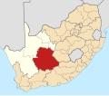
Faịlụ:Map of South Africa with Pixley ka Seme highlighted (2011).svg
Ọdịdị

Size of this PNG preview of this SVG file: 684 × 599 piksels. Ndị ọzọ mkpebi:274 × 240 piksels | 548 × 480 piksels | 876 × 768 piksels | 1,168 × 1,024 piksels | 2,337 × 2,048 piksels | 809 × 709 piksels.
Failụ si na nke mbu (usòrò SVG, nà áhà pixel 809 × 709, ívụ usòrò: 520 KB)
Ịta nke usòrò
Bìri èhì/ogè k'ị hụ òtù ụ̀fa dị̀ m̀gbè ahụ̀.
| Èhì/Ogè | Mbọ-aka | Ógólógó na asaá | Òjìème | Nkwute | |
|---|---|---|---|---|---|
| dị ùgbu â | 04:41, 14 Mee 2011 |  | 809 × 709 (520 KB) | Htonl | == Summary == {{Information |Description ={{en|1=Map of district boundaries in South Africa, as they will be after the municipal elections of 18 May 2011, with the w:Pixley ka Seme District Municipality |
Ojiji faịlụ
Ihe ndị na-eso ihe eji Ihu akwụkwọ eme na faịlụ a:
Ejiji failụ zụrụ ọha
Wikis ndi a edeputara na eji kwa failụ a:
- Ihe eji na af.wikipedia.org
- Orania
- Hopetown
- Douglas, Noord-Kaap
- Carnarvon
- Victoria-Wes
- Hutchinson
- Prieska
- Colesberg
- Vosburg
- Strydenburg
- Marydale
- De Aar
- Campbell
- Loxton
- Van Wyksvlei
- Richmond, Noord-Kaap
- Britstown
- Merriman
- Philipstown
- Petrusville
- Noupoort
- Niekerkshoop
- Norvalspont
- Hanover
- Vanderkloof
- Griekwastad
- Deelfontein
- Plooysburg
- Schmidtsdrif
- Sjabloonbespreking:Suid-Afrikaanse distriksmunisipaliteit navbox
- Ihe eji na ceb.wikipedia.org
- Ihe eji na en.wikipedia.org
- Hopetown
- Orania
- Hanover, South Africa
- Campbell, South Africa
- Griekwastad
- Britstown
- De Aar
- Pixley ka Seme District Municipality
- Deelfontein
- Colesberg
- Template:Pixley ka Seme District Municipality
- Carnarvon, South Africa
- Ubuntu Local Municipality
- Loxton, South Africa
- Vanwyksvlei
- Victoria West
- Vosburg
- Strydenburg
- Siyancuma Local Municipality
Lee more global usage of this file.

