
Usòrò:Solomon Islands adm location map.svg

Failụ si na nke mbu (usòrò SVG, nà áhà pixel 1,890 × 1,097, ívụ usòrò: 148 KB)
Mmẹkụwátá
| Nkówá |
Deutsch: Positionskarte der Salomonen
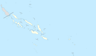
English: Location map of the Solomon Islands
|
||||||||||||
| Ǹgụ́ụ̀bọ̀chị̀ | |||||||||||||
| Mkpọlọ́gwụ̀ |
Own work using:
|
||||||||||||
| Odé ákwụ́kwọ́ | NordNordWest | ||||||||||||

|
This map has been made or improved in the German Kartenwerkstatt (Map Lab). You can propose maps to improve as well.
|
Nkwényé
Usage of this file with:

explanatory notes: Legally binding is only the full legalcode. For a free usage I recommend to respect the following licence conditions:
1. Provide my name as given above: NordNordWest,
2. a copy of, or the URI for, the applicable license: https://creativecommons.org/licenses/by-sa/3.0/de/legalcode,
3. the title of the work,
4. in the case of an adaptation, a credit identifying the use of the work in the adaptation.
This license and the rights granted hereunder will terminate automatically upon any breach by you of the terms of this license. Any of the above conditions can be waived if you get permission from the copyright holder. If you have questions or wish differing conditions, please contact me through nnwest or my discussion page ![]() t-online.de
t-online.de
- I wepulara nóru:
- i nye – ikọpị,ikekasi na izịpụ ọru a
- i dowaria – igbanwee ọrụ a
- Ọ ga bụ na ọnọdụ ndi a:
- í-kpó-áhà – Ị ga-enyerịrị ugo kwesịrị ekwesị, nye njikọ na ikikere ahụ, ma gosikwa ma emere mgbanwe. Ị nwere ike ime ya n'ụzọ ezi uche ọ bụla, mana ọ bụghị n'ụzọ ọ bụla na-egosi na onye nyere ikikere kwadoro gị maọbụ ojiji gị.
- gbásàa kà – Ọ bụrụ na ị tụgharịgharịa, gbanwee, ma ọ bụ wulite n'elu ihe ahụ, ị ga-ekesa ndenye gị n'okpuru otu ma ọ bụ ikike dakọtara dị ka nke mbụ.

Ịta nke usòrò
Bìri èhì/ogè k'ị hụ òtù ụ̀fa dị̀ m̀gbè ahụ̀.
| Èhì/Ogè | Mbọ-aka | Ógólógó na asaá | Òjìème | Nkwute | |
|---|---|---|---|---|---|
| dị ùgbu â | 16:54, 20 Novemba 2020 | | 1,890 × 1,097 (148 KB) | NordNordWest | corr |
| 18:36, 15 Maachị 2017 |  | 1,890 × 1,097 (147 KB) | NordNordWest | == {{int:filedesc}} == {{Information |Description= {{de|1=Positionskarte der Salomonen}} {{en|1=Location map of the Solomon Islands}} {{Location map series N |stretching=101 |top=-4.3 |bottom=-13.5 |left=154.4 |right=170.4 }} |Source={{Own using}} * Un... |
Ojiji faịlụ
Ọdighi ihuakwụkwọ nwere failụ a.
Ejiji failụ zụrụ ọha
Wikis ndi a edeputara na eji kwa failụ a:
- Ihe eji na ast.wikipedia.org
- Ḥoniara
- Módulu:Mapa de llocalización/datos/Islles Salomón
- Módulu:Mapa de llocalización/datos/Islles Salomón/usu
- Makira
- Kirakira
- Islles Florida
- Islles Nueva Xeorxa
- Vangunu
- Islla de Rennell
- Kolombangara
- Golfu de Kula
- Llaguna de Marovo
- Ranongga
- Nggatokae
- Simbo
- Islles Arnarvon
- Islla Bellona
- Islla de Ghizo
- Islles Duff
- Islla Malaita
- Islla de Savo
- Gavutu
- Islla Kennedy
- Islles Reef
- Islla Choiseul
- Vella Lavella
- Islla Nueva Xeorxa
- Tinakula
- Islla Furona
- Islla de Santa Isabel
- Malaita Sur
- Islla Nendö
- Taumako
- Rennell Este
- Islles Santa Cruz
- Tulagi
- Islla Fera
- Fatutaka
- Anuta
- Tikopia
- Pavuvu
- Utupua
- Ihe eji na bn.wikipedia.org
- Ihe eji na de.wikipedia.org
Lee more global usage of this file.