
Usòrò:Aïn Témouchent communes de la wilaya.png
Otu nyochaa a ha:800 × 546 piksels Ndị ọzọ mkpebi:320 × 219 piksels | 640 × 437 piksels | 1,024 × 699 piksels | 1,280 × 874 piksels | 2,000 × 1,366 piksels.
Failụ si na nke mbu (2,000 × 1,366 pixel, ívù akwukwo orunótu: 131 KB, MIME nke: image/png)
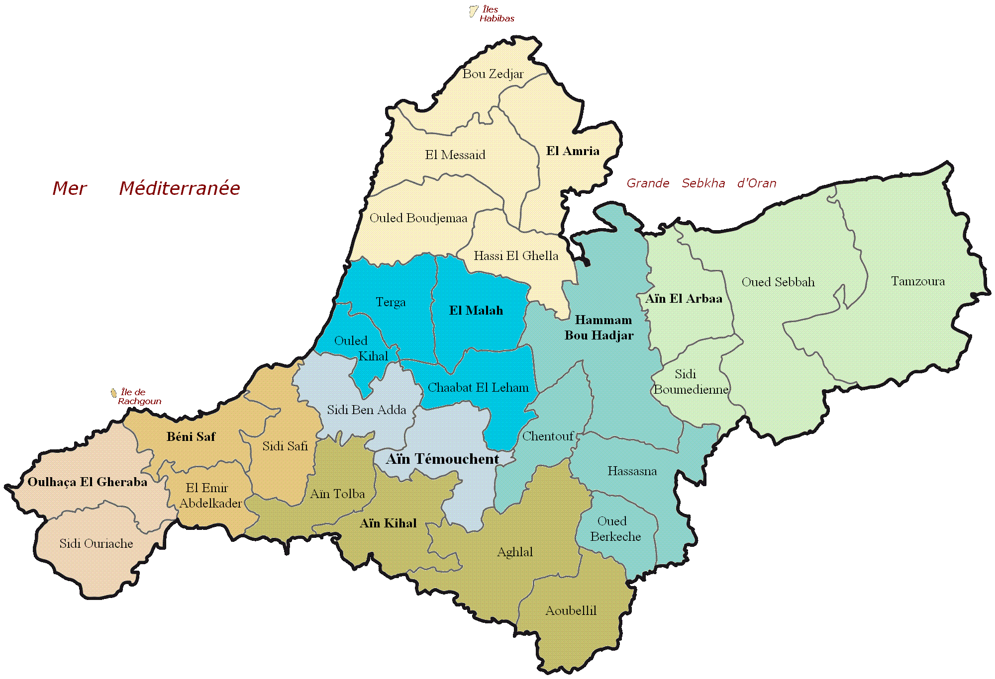
| Nkówá | Carte administrative de la wilaya d'Aïn Témouchent |
| Ǹgụ́ụ̀bọ̀chị̀ | (UTC) |
| Mkpọlọ́gwụ̀ | |
| Odé ákwụ́kwọ́ |
|
_map.svg)
| This is a retouched picture, which means that it has been digitally altered from its original version. Modifications: Nom des communes de la wilaya d'Aïn Témouchent. The original can be viewed here: Dz - Wilaya de Aïn Témouchent (46) map.svg:
|
I, the copyright holder of this work, hereby publish it under the following licenses:
This file is licensed under the Creative Commons Attribution-Share Alike 3.0 Unported, 2.5 Generic, 2.0 Generic and 1.0 Generic license.
- I wepulara nóru:
- i nye – ikọpị,ikekasi na izịpụ ọru a
- i dowaria – igbanwee ọrụ a
- Ọ ga bụ na ọnọdụ ndi a:
- í-kpó-áhà – Ị ga-enyerịrị ugo kwesịrị ekwesị, nye njikọ na ikikere ahụ, ma gosikwa ma emere mgbanwe. Ị nwere ike ime ya n'ụzọ ezi uche ọ bụla, mana ọ bụghị n'ụzọ ọ bụla na-egosi na onye nyere ikikere kwadoro gị maọbụ ojiji gị.
- gbásàa kà – Ọ bụrụ na ị tụgharịgharịa, gbanwee, ma ọ bụ wulite n'elu ihe ahụ, ị ga-ekesa ndenye gị n'okpuru otu ma ọ bụ ikike dakọtara dị ka nke mbụ.

|
Í nwèrèíkí jé, gbạsáa na/ma í mezí akwukwo nka na okpúrù íwú GNU Ákwúkwó Íwú nke Owéré, Nké 1.2 ma nke íchè ndi Free Software Foundation; wéfùtàrà; na adighi nkejị di íchẹ, adighi édé nke Ihú-Ihü Ákwúkwó, na adighi Ázú-Ihü Ákwúkwó. Ákwúkwó iwu hé jéré jé di na nkeji kpóró GNU Ákwúkwó Íwú nke Owéré". |
Ị nwere ike họrọ ikikere nke masịrị gị.
Original upload log
This image is a derivative work of the following images:
- File:Dz_-_Wilaya_de_Aïn_Témouchent_(46)_map.svg licensed with Cc-by-sa-3.0,2.5,2.0,1.0, GFDL
- 2011-02-18T20:41:43Z Indif 1272x869 (221159 Bytes)
Uploaded with derivativeFX
Original upload log
| Èhì/Ogè | Ógólógó na asaá | Òjìème | Nkwute |
|---|---|---|---|
| 19 Febụwarị 2011, 11:21:49 | 2000 × 1366 (168969 bytes) | Tmouchentois (ṅkátá · mmetara) | {{Information |Description=Daïra de la wilaya de Tizi-Ouzou |Source=*[[:File:Dz_-_Wilaya_de_Aïn_Témouchent_(46)_map.svg|]] |Date=2011-02-19 11:17 (UTC) |Author=*[[:File:Dz_-_Wilaya_de_Aïn_Témouchent_(46)_map.svg|]]: Indif *derivative work: ~~~ |Permi |
Ịta nke usòrò
Bìri èhì/ogè k'ị hụ òtù ụ̀fa dị̀ m̀gbè ahụ̀.
| Èhì/Ogè | Mbọ-aka | Ógólógó na asaá | Òjìème | Nkwute | |
|---|---|---|---|---|---|
| dị ùgbu â | 11:55, 21 Ọgọọst 2014 | | 2,000 × 1,366 (131 KB) | GifTagger | Bot: Converting file to superior PNG file. (Source: Aïn_Témouchent_communes_de_la_wilaya.GIF). This GIF was problematic due to non-greyscale color table. |
Ojiji faịlụ
Ihe ndị na-eso ihe eji Ihu akwụkwọ eme na faịlụ a:
Ejiji failụ zụrụ ọha
Wikis ndi a edeputara na eji kwa failụ a:
- Ihe eji na azb.wikipedia.org
- Ihe eji na az.wikipedia.org
- Ihe eji na ca.wikipedia.org
- Ihe eji na ceb.wikipedia.org
- Ihe eji na de.wikipedia.org
- Ihe eji na en.wikipedia.org
- Ihe eji na eo.wikipedia.org
- Ihe eji na es.wikipedia.org
- Ihe eji na eu.wikipedia.org
- Ihe eji na fr.wikipedia.org
- Ihe eji na gl.wikipedia.org
- Ihe eji na ha.wikipedia.org
- Ihe eji na ja.wikipedia.org
- Ihe eji na kab.wikipedia.org
- Ihe eji na no.wikipedia.org
- Ihe eji na pl.wikipedia.org
- Ihe eji na pt.wikipedia.org
- Ihe eji na ro.wikipedia.org
- Ihe eji na ru.wikipedia.org
- Ihe eji na sco.wikipedia.org
- Ihe eji na simple.wikipedia.org
- Ihe eji na sr.wikipedia.org
- Ihe eji na sv.wikipedia.org
- Ihe eji na sw.wikipedia.org
- Ihe eji na ts.wikipedia.org
- Ihe eji na tum.wikipedia.org
- Ihe eji na uk.wikipedia.org
- Ihe eji na ur.wikipedia.org
- Ihe eji na uz.wikipedia.org
- Ihe eji na www.wikidata.org
- Ihe eji na yo.wikipedia.org
- Ihe eji na zu.wikipedia.org