
Usòrò:India Nepal Locator.png
Nke káchá mmá na ányá àdíghị.
India_Nepal_Locator.png (526 × 400 pixel, ívù akwukwo orunótu: 17 KB, MIME nke: image/png)
Mmẹkụwátá
| Nkówá |
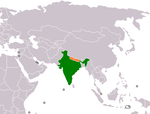
English: Bilateral locator map of India and Nepal. |
| Ǹgụ́ụ̀bọ̀chị̀ | 6 Maachị 2008 (original upload date) |
| Mkpọlọ́gwụ̀ | Orü ọnwé |
| Odé ákwụ́kwọ́ | Aridd |
Nkwényé
| |
This work has been released into the public domain by its author, Aridd, at the Bekee Wikipedia project. This applies worldwide. In case this is not legally possible: |
| Warning! According to Indian law, it is illegal to produce maps that in the view of the Indian government, misrepresent Indian territories by showing areas the Indian government claims ownership of but does not control as not belonging to India or as being contested. |
Original upload log
The original description page was here. All following user names refer to en.wikipedia.
- 2008-03-06 00:12 Aridd 526×400× (17057 bytes) Own work, based on Wikipedia blank map.
Ịta nke usòrò
Bìri èhì/ogè k'ị hụ òtù ụ̀fa dị̀ m̀gbè ahụ̀.
| Èhì/Ogè | Mbọ-aka | Ógólógó na asaá | Òjìème | Nkwute | |
|---|---|---|---|---|---|
| dị ùgbu â | 02:17, 1 Jenụwarị 2012 | | 526 × 400 (17 KB) | File Upload Bot (Magnus Manske) | {{BotMoveToCommons|en.wikipedia|year={{subst:CURRENTYEAR}}|month={{subst:CURRENTMONTHNAME}}|day={{subst:CURRENTDAY}}}} {{Information |Description={{en|Own work, based on Wikipedia blank map.}} |Source=Transferred from [http://en.wikipedia.org en.wikipedi |
Ojiji faịlụ
Ihe ndị na-eso ihe eji Ihu akwụkwọ eme na faịlụ a:
Ejiji failụ zụrụ ọha
Wikis ndi a edeputara na eji kwa failụ a:
- Ihe eji na en.wikipedia.org
- Ihe eji na es.wikipedia.org
- Ihe eji na fa.wikipedia.org
- Ihe eji na it.wikipedia.org
- Ihe eji na pt.wikipedia.org
- Ihe eji na ru.wikipedia.org
- Ihe eji na uz.wikipedia.org