Usòrò:Makambako.png

Page contents not supported in other languages.
Shí Wikipedia, njikotá édémédé nke onyobulạ

Failụ si na nke mbu(538 × 610 pixel, ívù akwukwo orunótu: 716 KB, MIME nke: image/png)

Failụ a si na Wikimedia Commons,enwekwara ike iji ya eme ihe na arụmarụ ọzọ. Nkọwa na ihuakwukwọ nkọwa failụ eziri na okpuru.

Mmẹkụwátá

This map image could be re-created using vector graphics as an SVG file. This has several advantages; see Commons:Media for cleanup for more information. If an SVG form of this image is available, please upload it and afterwards replace this template with {{vector version available|new image name}}.


It is recommended to name the SVG file “Makambako.svg”—then the template Vector version available (or Vva) does not need the new image name parameter.
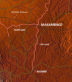
Nkówá Map of Makambako, Njombe District, Tanzania
Ǹgụ́ụ̀bọ̀chị̀
Mkpọlọ́gwụ̀ http://www.maps-for-free.com/
Odé ákwụ́kwọ́ Modified by Dr. Blofeld
Ọdà
(Í jí kwá usòrò nke)
http://www.maps-for-free.com/html/about.html

Nkwényé

This screenshot either does not contain copyright-eligible parts or visuals of copyrighted software, or the author has released it under a free license (which should be indicated beneath this notice), and as such follows the licensing guidelines for screenshots of Wikimedia Commons. You may use it freely according to its particular license. Free software license:

GNU head

This work is free software; you can redistribute it and/or modify it under the terms of the GNU General Public License as published by the Free Software Foundation; either version 2 of the License, or any later version. This work is distributed in the hope that it will be useful, but without any warranty; without even the implied warranty of merchantability or fitness for a particular purpose. See version 2 and version 3 of the GNU General Public License for more details.

Note: if the screenshot shows any work that is not a direct result of the program code itself, such as a text or graphics that are not part of the program, the license for that work must be indicated separately.


Nkwényé

w:en:Creative Commons
í-kpó-áhà
Usòrò nke á di okpúrù ákwúkwó íwú nke Mmẹ Òkike Tu ụta Ñkịtị édé íwú nke Í kpó áhà nke ádịghị na úlò 3.0.
I wepulara nóru:
  • i nye – ikọpị,ikekasi na izịpụ ọru a
  • i dowaria – igbanwee ọrụ a
Ọ ga bụ na ọnọdụ ndi a:
  • í-kpó-áhà – Ị ga-enyerịrị ugo kwesịrị ekwesị, nye njikọ na ikikere ahụ, ma gosikwa ma emere mgbanwe. Ị nwere ike ime ya n'ụzọ ezi uche ọ bụla, mana ọ bụghị n'ụzọ ọ bụla na-egosi na onye nyere ikikere kwadoro gị maọbụ ojiji gị.

Nkowapụta

Tinye nkọwa otu ahịrị ihe faịlụ a na-anochi anya ya.

Ihe ndị egosiri na faịlụ a

depicts Bekee

24 Ọktoba 2010

image/png

Ịta nke usòrò

Bìri èhì/ogè k'ị hụ òtù ụ̀fa dị̀ m̀gbè ahụ̀.

Èhì/OgèMbọ-akaÓgólógó na asaáÒjìèmeNkwute
dị ùgbu â11:18, 24 Ọktoba 2010NvóÁká màkà otù ȯ dị nà 11:18, 24 Ọktoba 2010538 × 610 (716 KB)Blofeld Dr.== Summary == {{convert to SVG|map}} {{Information |Description=Map of Makambako, Njombe District, Tanzania |Source=http://www.maps-for-free.com/ |Date=2010-10-24 |Author=Modified by Dr. Blofeld |Permission=http://www.maps-for-free.com/html/about.html |ot

Ihe ndị na-eso ihe eji Ihu akwụkwọ eme na faịlụ a:

Ejiji failụ zụrụ ọha

Wikis ndi a edeputara na eji kwa failụ a: