
Usòrò:Mount Pulag, Kabayan, Philippines (Unsplash).jpg

Otu nyochaa a ha:800 × 536 piksels Ndị ọzọ mkpebi:320 × 214 piksels | 640 × 428 piksels | 1,024 × 685 piksels | 1,280 × 857 piksels | 2,560 × 1,714 piksels | 3,872 × 2,592 piksels.
Failụ si na nke mbu (3,872 × 2,592 pixel, ívù akwukwo orunótu: 3.45 MB, MIME nke: image/jpeg)
.jpg)
Mmẹkụwátá
| Nkówá |
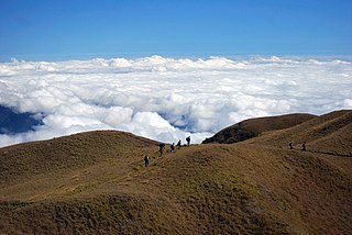
English: Mount Pulag, Kabayan, Philippines |
| Ǹgụ́ụ̀bọ̀chị̀ | |
| Mkpọlọ́gwụ̀ |
https://unsplash.com/photos/kCGhXLU32Bg
|
| Odé ákwụ́kwọ́ | Joanne Caselyn Suarez joannecaselynsuarez |
| Unsplash title | None |
| Categories | Nature |
| EXIF | exposure_time: 1/4000 · make: Nikon · iso: 200 · focal_length: 55 · aperture: 5.0 · model: NIKON D80 |
| Place | Mount Pulag, Kabayan, Philippines |
| Camera location | | View this and other nearby images on: OpenStreetMap |
|---|
.jpg¶ms=016.597500_N_0120.899167_E_globe:Earth_type:camera__&language=ig)
Nkwényé

|
This image is from Unsplash and was published prior to 5 June 2017 under the Creative Commons CC0 1.0 Universal Public Domain Dedication. Note: On 5 Jụn 2017, Unsplash switched the old sitewide license for all uploads from Creative Commons CC0 to a custom license arrangement which does not meet the free content licensing requirements for Commons. Therefore, media published on Unsplash from 5 Jụn 2017 onwards is not considered to be freely licensed and can't be accepted on Commons. Files uploaded to Commons after this date should be subject to careful license review, verifying that the publication date on Unsplash is prior to 5 Jụn 2017.
|
| This file is made available under the Creative Commons CC0 1.0 Universal Public Domain Dedication. | |
| The person who associated a work with this deed has dedicated the work to the public domain by waiving all of their rights to the work worldwide under copyright law, including all related and neighboring rights, to the extent allowed by law. You can copy, modify, distribute and perform the work, even for commercial purposes, all without asking permission.
|
Ịta nke usòrò
Bìri èhì/ogè k'ị hụ òtù ụ̀fa dị̀ m̀gbè ahụ̀.
| Èhì/Ogè | Mbọ-aka | Ógólógó na asaá | Òjìème | Nkwute | |
|---|---|---|---|---|---|
| dị ùgbu â | 12:46, 11 Septemba 2017 | | 3,872 × 2,592 (3.45 MB) | Fæ | Unsplash travel:80 Joanne Caselyn Suarez https://unsplash.com/photos/kCGhXLU32Bg #25 |
Ojiji faịlụ
Ihe ndị na-eso ihe eji Ihu akwụkwọ eme na faịlụ a:
Ejiji failụ zụrụ ọha
Wikis ndi a edeputara na eji kwa failụ a:
- Ihe eji na en.wikipedia.org
.jpg)