
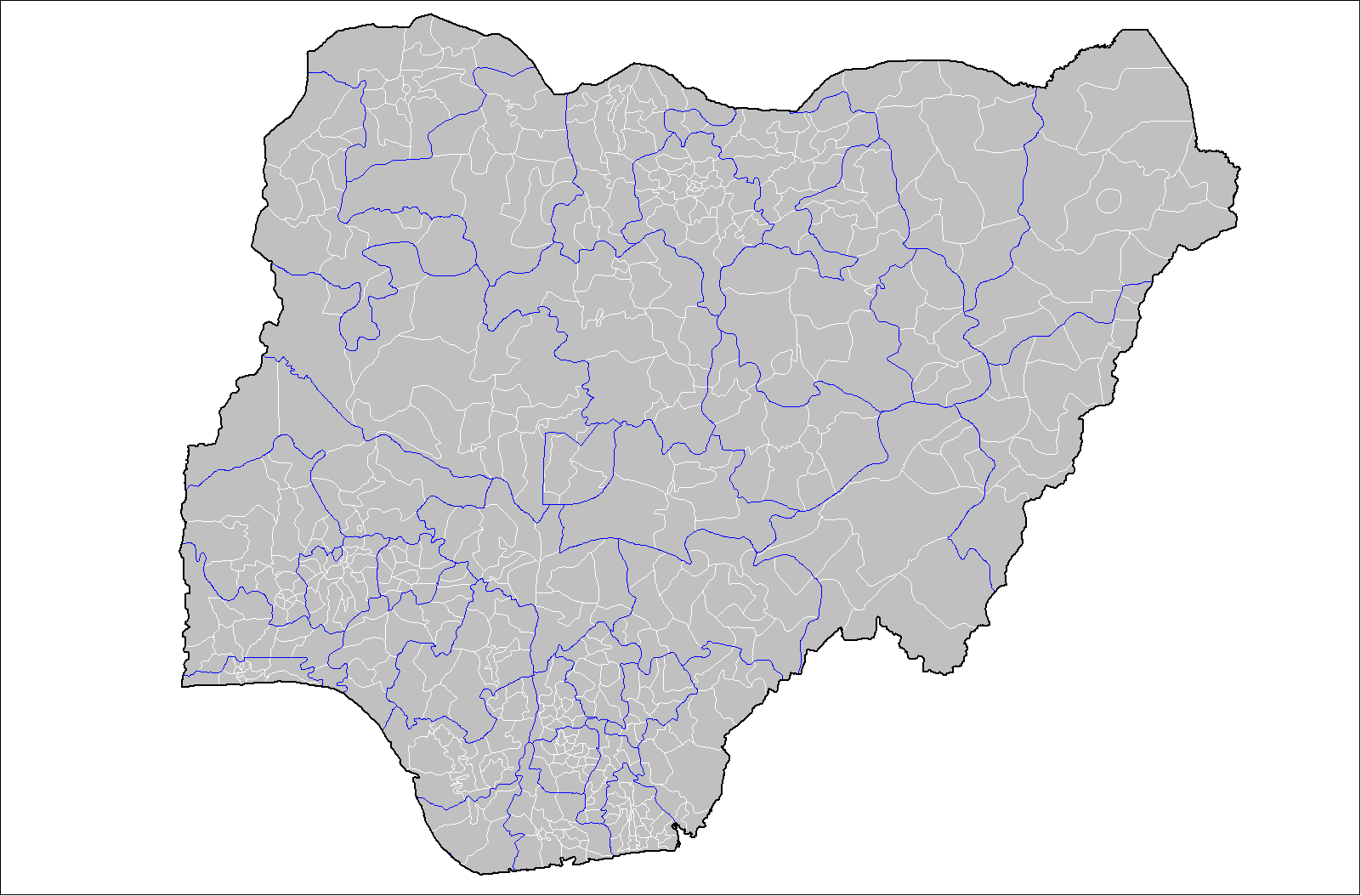
Usòrò:Nigeria Local Government Areas.png
Otu nyochaa a ha:800 × 527 piksels Ndị ọzọ mkpebi:320 × 211 piksels | 640 × 421 piksels | 1,024 × 674 piksels | 1,280 × 843 piksels | 1,601 × 1,054 piksels.
Failụ si na nke mbu (1,601 × 1,054 pixel, ívù akwukwo orunótu: 71 KB, MIME nke: image/png)
Birnin magaji
Mmẹkụwátá
| Nkówá | Map of the local government areas of Nigeria. Created by Rarelibra 15:42, 12 July 2007 (UTC) using MapInfo Professional v8.5 and various mapping resources. |
| Ǹgụ́ụ̀bọ̀chị̀ | 12 Julaị 2007 (original upload date) |
| Mkpọlọ́gwụ̀ | No machine-readable source provided. Own work assumed (based on copyright claims). |
| Odé ákwụ́kwọ́ | No machine-readable author provided. Rarelibra assumed (based on copyright claims). |
Nkwényé
| This work has been released into the public domain by its author, I, Rarelibra. This applies worldwide. In some countries this may not be legally possible; if so: I, Rarelibra grants anyone the right to use this work for any purpose, without any conditions, unless such conditions are required by law. |
Ịta nke usòrò
Bìri èhì/ogè k'ị hụ òtù ụ̀fa dị̀ m̀gbè ahụ̀.
| Èhì/Ogè | Mbọ-aka | Ógólógó na asaá | Òjìème | Nkwute | |
|---|---|---|---|---|---|
| dị ùgbu â | 15:42, 12 Julaị 2007 | | 1,601 × 1,054 (71 KB) | Rarelibra | Map of the local government areas of Nigeria. Created by ~~~~ using MapInfo Professional v8.5 and various mapping resources. |
Ojiji faịlụ
Ọdighi ihuakwụkwọ nwere failụ a.
Ejiji failụ zụrụ ọha
Wikis ndi a edeputara na eji kwa failụ a:
- Ihe eji na da.wikipedia.org
- Ihe eji na de.wikipedia.org
- Ihe eji na en.wikipedia.org
- Ihe eji na es.wikipedia.org
- Ihe eji na fr.wikipedia.org
- Ihe eji na gl.wikipedia.org
- Ihe eji na ha.wikipedia.org
- Ihe eji na it.wikipedia.org
- Ihe eji na kcg.wikipedia.org
- Ihe eji na pt.wikipedia.org
- Ihe eji na ru.wikipedia.org
- Ihe eji na ur.wikipedia.org
- Ihe eji na www.wikidata.org
- Ihe eji na yo.wikipedia.org
- Ihe eji na zh.wikipedia.org