
Usòrò:Northbound entering Gorongosa District.JPG

Otu nyochaa a ha:800 × 462 piksels Ndị ọzọ mkpebi:320 × 185 piksels | 640 × 369 piksels | 1,031 × 595 piksels.
Failụ si na nke mbu (1,031 × 595 pixel, ívù akwukwo orunótu: 123 KB, MIME nke: image/jpeg)
Mmẹkụwátá
| Nkówá |
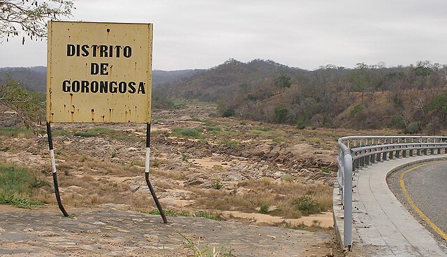
English: Travelling north on the main north-south highway of Mozambique (the EN1), entering the Gorongosa District. The bridge over the Rio Púnguè continues to the right of the photo. Note that river's low water level is typical of the late dry season. |
||
| Ǹgụ́ụ̀bọ̀chị̀ | |||
| Mkpọlọ́gwụ̀ | Orü ọnwé | ||
| Odé ákwụ́kwọ́ | Brian Dell | ||
| Ọdà (Í jí kwá usòrò nke) |
|
| Camera location | | View this and other nearby images on: OpenStreetMap |
|---|
Ịta nke usòrò
Bìri èhì/ogè k'ị hụ òtù ụ̀fa dị̀ m̀gbè ahụ̀.
| Èhì/Ogè | Mbọ-aka | Ógólógó na asaá | Òjìème | Nkwute | |
|---|---|---|---|---|---|
| dị ùgbu â | 08:07, 11 Novemba 2008 | | 1,031 × 595 (123 KB) | Bdell555 | {{Information |Description={{en|1=Travelling north on the main north-south highway of Mozambique, entering the Gorongosa District. The bridge continues to the right of the photo. Note that the river's low water level is typical of the late dry season.}} |
Ojiji faịlụ
Ihe ndị na-eso ihe eji Ihu akwụkwọ eme na faịlụ a:
Ejiji failụ zụrụ ọha
Wikis ndi a edeputara na eji kwa failụ a:
- Ihe eji na ca.wikipedia.org
- Ihe eji na ceb.wikipedia.org
- Ihe eji na en.wikipedia.org
- Ihe eji na fi.wikipedia.org
- Ihe eji na ha.wikipedia.org
- Ihe eji na no.wikipedia.org
- Ihe eji na pt.wikipedia.org
- Ihe eji na ts.wikipedia.org
- Ihe eji na www.wikidata.org
- Ihe eji na yo.wikipedia.org
- Ihe eji na zh-min-nan.wikipedia.org
- Ihe eji na zh.wikipedia.org
- Ihe eji na zu.wikipedia.org