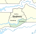
Usòrò:Senegal Sed Bou.svg

Size of this PNG preview of this SVG file: 343 × 325 piksels. Ndị ọzọ mkpebi:253 × 240 piksels | 507 × 480 piksels | 811 × 768 piksels | 1,081 × 1,024 piksels | 2,161 × 2,048 piksels.
Failụ si na nke mbu (usòrò SVG, nà áhà pixel 343 × 325, ívụ usòrò: 1.42 MB)
Ịta nke usòrò
Bìri èhì/ogè k'ị hụ òtù ụ̀fa dị̀ m̀gbè ahụ̀.
| Èhì/Ogè | Mbọ-aka | Ógólógó na asaá | Òjìème | Nkwute | |
|---|---|---|---|---|---|
| dị ùgbu â | 13:38, 11 Maachị 2017 |  | 343 × 325 (1.42 MB) | Amitchell125 | word removed |
| 13:34, 11 Maachị 2017 |  | 343 × 325 (1.42 MB) | Amitchell125 | User created page with UploadWizard |
Ojiji faịlụ
Ihe ndị na-eso ihe eji Ihu akwụkwọ eme na faịlụ a:
Ejiji failụ zụrụ ọha
Wikis ndi a edeputara na eji kwa failụ a:
- Ihe eji na en.wikipedia.org
- Ihe eji na fa.wikipedia.org
- Ihe eji na ha.wikipedia.org
- Ihe eji na ja.wikipedia.org
- Ihe eji na ts.wikipedia.org
- Ihe eji na zh-min-nan.wikipedia.org
- Ihe eji na zh.wikipedia.org

