
Usòrò:Txu-oclc-6595921-nc30-15.jpg

Otu nyochaa a ha:792 × 600 piksels Ndị ọzọ mkpebi:317 × 240 piksels | 634 × 480 piksels | 1,015 × 768 piksels | 1,280 × 969 piksels | 2,560 × 1,938 piksels | 5,000 × 3,785 piksels.
Failụ si na nke mbu (5,000 × 3,785 pixel, ívù akwukwo orunótu: 5.02 MB, MIME nke: image/jpeg)
Mmẹkụwátá
| Nkówá |
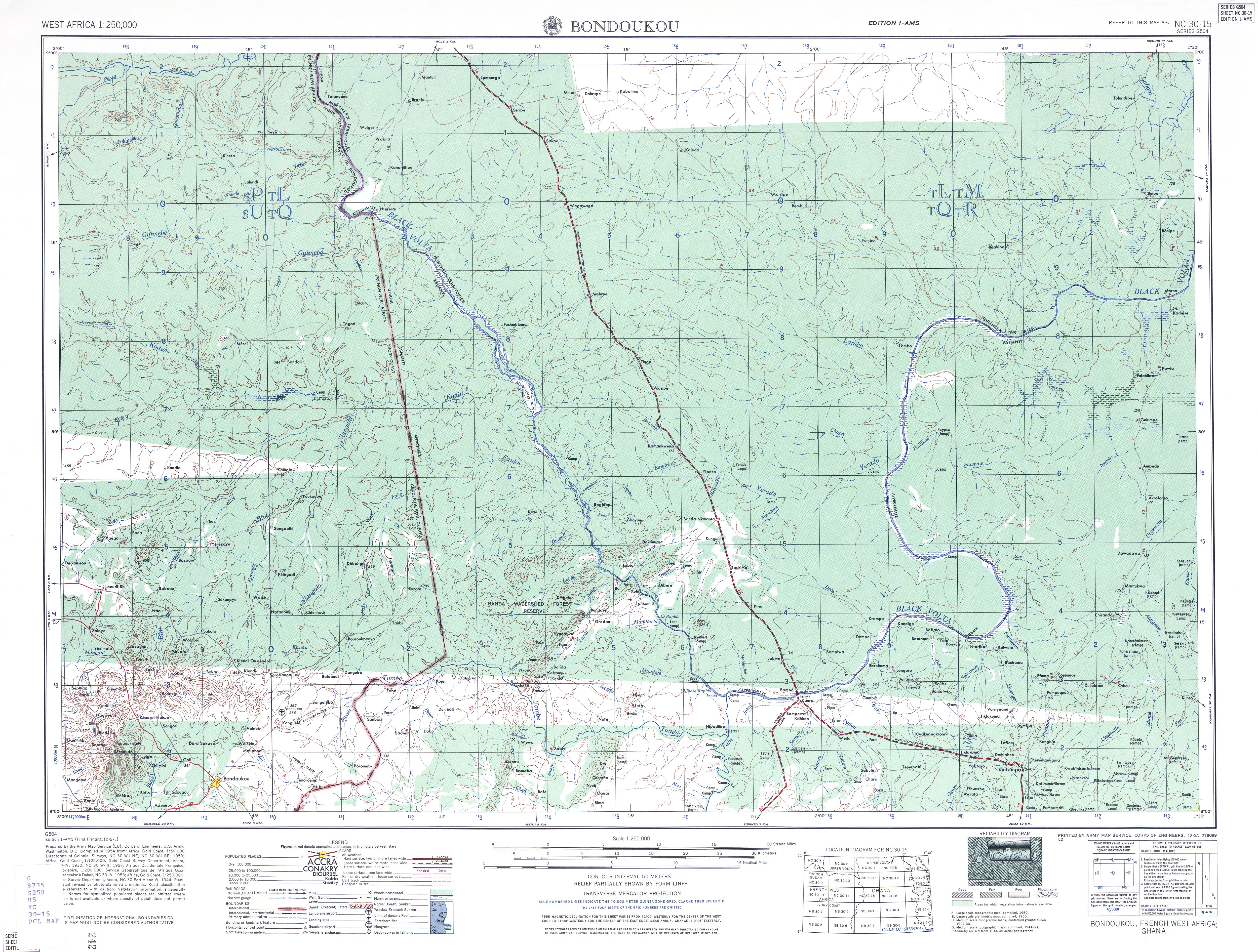
English: US Army map of West Africa, specifically the area along northern border of modern Ghana and Cote d'Ivoire (then Gold Coast Colony and French West Africa). |
| Ǹgụ́ụ̀bọ̀chị̀ | |
| Mkpọlọ́gwụ̀ | http://www.lib.utexas.edu/maps/ams/west_africa/txu-oclc-6595921-nc30-15.jpg |
| Odé ákwụ́kwọ́ | Army Map Service, US Army |
| Ọdà (Í jí kwá usòrò nke) |
PD-US Government |
| Nke ya ozor | Derivative works of this file: Txu-oclc-6595921-nc30-15 crop southwest.jpg |
Nkwényé
This file is a work of a U.S. Army soldier or employee, taken or made as part of that person's official duties. As a work of the U.S. federal government, it is in the public domain in the United States.
|
 |
Ịta nke usòrò
Bìri èhì/ogè k'ị hụ òtù ụ̀fa dị̀ m̀gbè ahụ̀.
| Èhì/Ogè | Mbọ-aka | Ógólógó na asaá | Òjìème | Nkwute | |
|---|---|---|---|---|---|
| dị ùgbu â | 01:15, 13 Septemba 2008 | | 5,000 × 3,785 (5.02 MB) | T L Miles | {{Information |Description={{en|1=US Army map of West Africa, specifically the area along northern border of modern Ghana and Cote d'Ivoire (then Gold Coast Colony and French West Africa).}} |Source=http://www.lib.utexas.edu/maps/ams/west_africa/txu-oclc- |
Ojiji faịlụ
Ọdighi ihuakwụkwọ nwere failụ a.
Ejiji failụ zụrụ ọha
Wikis ndi a edeputara na eji kwa failụ a:
- Ihe eji na de.wikipedia.org