
Usòrò:WW Samara Bend - Geocover 2000.png
Otu nyochaa a ha:800 × 585 piksels Ndị ọzọ mkpebi:320 × 234 piksels | 640 × 468 piksels | 926 × 677 piksels.
Failụ si na nke mbu (926 × 677 pixel, ívù akwukwo orunótu: 1.66 MB, MIME nke: image/png)
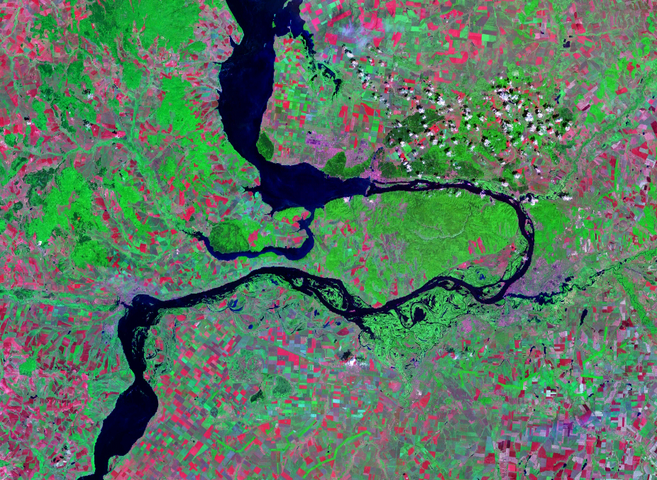
| Nkówá | Satellite image of the Samara Bend in the Volga River | |||
| Ǹgụ́ụ̀bọ̀chị̀ | Geocover 2000 dataset | |||
| Mkpọlọ́gwụ̀ | Nasa World Wind | |||
| Odé ákwụ́kwọ́ | Nasa | |||
| Ọdà (Í jí kwá usòrò nke) |
|

Ịta nke usòrò
Bìri èhì/ogè k'ị hụ òtù ụ̀fa dị̀ m̀gbè ahụ̀.
| Èhì/Ogè | Mbọ-aka | Ógólógó na asaá | Òjìème | Nkwute | |
|---|---|---|---|---|---|
| dị ùgbu â | 13:28, 14 Ọgọọst 2007 | | 926 × 677 (1.66 MB) | Hardscarf | |
| 13:20, 14 Ọgọọst 2007 |  | 1,024 × 677 (1.48 MB) | Hardscarf | {{Information |Description=Satellite image of the Samara Bend in the Volga River |Source=Nasa World Wind |Date=Geocover 2000 dataset |Author=Nasa |Permission={{PD-World Wind}} |other_versions= }} Category:Samara Oblast Category:Volga River |
Ojiji faịlụ
Ihe ndị na-eso ihe eji Ihu akwụkwọ eme na faịlụ a:
Ejiji failụ zụrụ ọha
Wikis ndi a edeputara na eji kwa failụ a:
- Ihe eji na be-tarask.wikipedia.org
- Ihe eji na be.wikipedia.org
- Ihe eji na cv.wikipedia.org
- Ihe eji na en.wikipedia.org
- Ihe eji na es.wikipedia.org
- Ihe eji na fr.wikipedia.org
- Ihe eji na hu.wikipedia.org
- Ihe eji na ja.wikipedia.org
- Ihe eji na la.wikipedia.org
- Ihe eji na mk.wikipedia.org
- Ihe eji na nl.wikipedia.org
- Ihe eji na pl.wikipedia.org
- Ihe eji na pt.wikipedia.org
- Ihe eji na ru.wikipedia.org
- Ihe eji na sr.wikipedia.org
- Ihe eji na uk.wikipedia.org
- Ihe eji na www.wikidata.org