
Usòrò:Chad sat.jpg

Otu nyochaa a ha:394 × 599 piksels Ndị ọzọ mkpebi:158 × 240 piksels | 316 × 480 piksels | 505 × 768 piksels | 1,265 × 1,922 piksels.
Failụ si na nke mbu (1,265 × 1,922 pixel, ívù akwukwo orunótu: 1.79 MB, MIME nke: image/jpeg)
Mmẹkụwátá
| Nkówá |
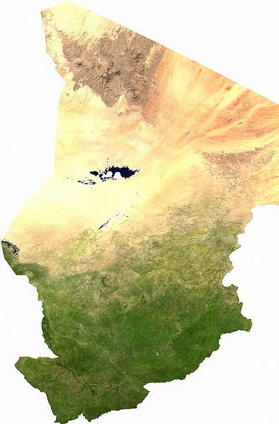
Español: Mapa satelital de Chad, se puede apreciar el contraste entre la zona árida del norte, que corresponde al sur del Sahara; y la zona fértil del sur.
Los musulmanes del norte piden privilegios económicos.
|
| Ǹgụ́ụ̀bọ̀chị̀ | |
| Mkpọlọ́gwụ̀ | user |
| Odé ákwụ́kwọ́ | Cwolfsheep |
Nkwényé
| This file is in the public domain, because it was generated by a user, using free sources available at The Map Library.
Note that this does not include the maps in the Global Administrative Areas section of the homepage. |
Ịta nke usòrò
Bìri èhì/ogè k'ị hụ òtù ụ̀fa dị̀ m̀gbè ahụ̀.
| Èhì/Ogè | Mbọ-aka | Ógólógó na asaá | Òjìème | Nkwute | |
|---|---|---|---|---|---|
| dị ùgbu â | 03:43, 13 Julaị 2006 | | 1,265 × 1,922 (1.79 MB) | Unquietwiki | ECW to TIFF to JPEG (100% quality; progressive formatting). {{PD-MapLibrary}} |
Ojiji faịlụ
Ihe ndị na-eso ihe eji Ihu akwụkwọ eme na faịlụ a:
Ejiji failụ zụrụ ọha
Wikis ndi a edeputara na eji kwa failụ a:
- Ihe eji na af.wikipedia.org
- Ihe eji na als.wikipedia.org
- Ihe eji na ar.wikipedia.org
- Ihe eji na bg.wikipedia.org
- Ihe eji na bs.wikipedia.org
- Ihe eji na ca.wikipedia.org
- Ihe eji na da.wikipedia.org
- Tchad
- Tchads historie
- Wikipedia:Dagens skandinaviske artikel/september 2009
- Wikipedia:Dagens skandinaviske artikel/Svensk/Uge 36, 2009
- Wikipedia:Dagens skandinaviske artikel/august 2012
- Wikipedia:Dagens skandinaviske artikel/Bokmål/Uge 32, 2012
- Wikipedia:Dagens skandinaviske artikel/maj 2014
- Wikipedia:Dagens skandinaviske artikel/Søndag/Uge 20, 2014
- Ihe eji na de.wikipedia.org
- Ihe eji na de.wikiversity.org
- Ihe eji na el.wikipedia.org
- Ihe eji na en.wikipedia.org
- Ihe eji na eo.wikipedia.org
- Ihe eji na es.wikipedia.org
- Ihe eji na eu.wikipedia.org
- Ihe eji na fa.wikipedia.org
- Ihe eji na fr.wikipedia.org
- Ihe eji na hu.wikipedia.org
- Ihe eji na is.wikipedia.org
- Ihe eji na it.wikipedia.org
- Ihe eji na ja.wikipedia.org
- Ihe eji na ka.wikipedia.org
- Ihe eji na kk.wikipedia.org
- Ihe eji na li.wikipedia.org
- Ihe eji na mn.wikipedia.org
- Ihe eji na mt.wikipedia.org
- Ihe eji na nn.wikipedia.org
- Ihe eji na no.wikipedia.org
Lee more global usage of this file.