
Usòrò:Nigeria 1960-1963.png
Otu nyochaa a ha:676 × 600 piksels Ndị ọzọ mkpebi:271 × 240 piksels | 541 × 480 piksels | 866 × 768 piksels | 1,154 × 1,024 piksels | 1,869 × 1,658 piksels.
Failụ si na nke mbu (1,869 × 1,658 pixel, ívù akwukwo orunótu: 90 KB, MIME nke: image/png)

|
This historical map image could be re-created using vector graphics as an SVG file. This has several advantages; see Commons:Media for cleanup for more information. If an SVG form of this image is available, please upload it and afterwards replace this template with
{{vector version available|new image name}}.
It is recommended to name the SVG file “Nigeria 1960-1963.svg”—then the template Vector version available (or Vva) does not need the new image name parameter. |
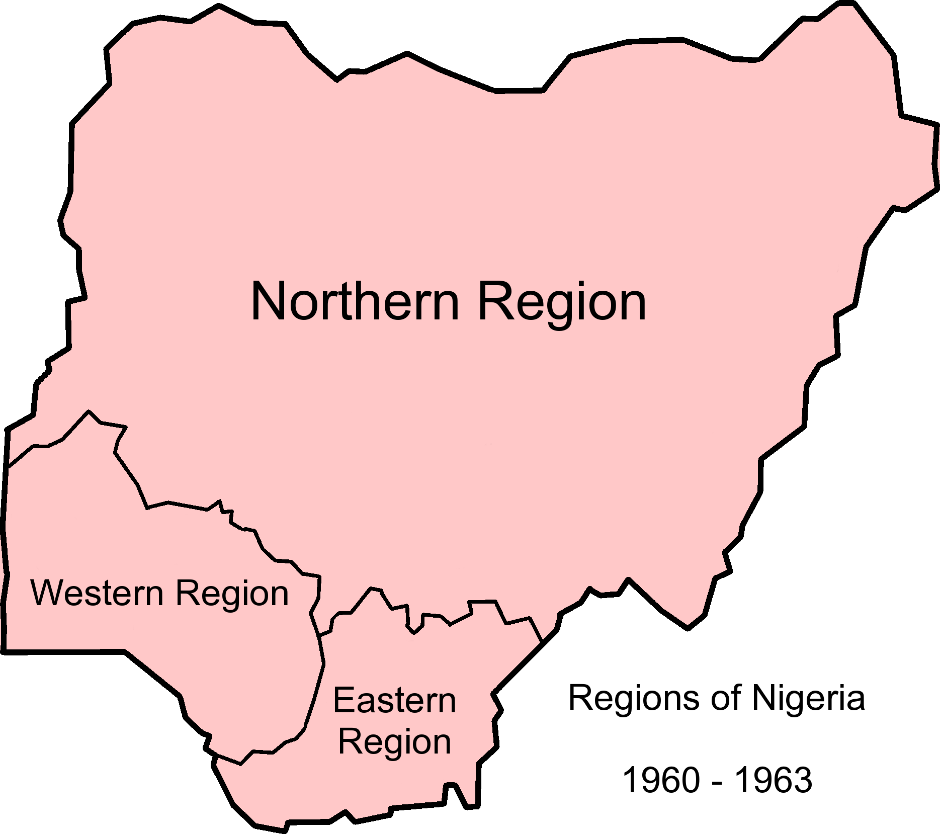
| Nkówá | Map of Nigerian regions, 1960-1963. Info from http://www.statoids.com/ung.html, http://www.zum.de/whkmla/region/westafrica/nigeriaind.html and http://hdl.loc.gov/loc.gmd/g8840.ct003019 |
| Ǹgụ́ụ̀bọ̀chị̀ | (UTC) |
| Mkpọlọ́gwụ̀ | |
| Odé ákwụ́kwọ́ |
|
Edebere faịlụ a n'okpuru ikikeree Creative Commons Attribution-Share Alike 3.0 Unported license.
- I wepulara nóru:
- i nye – ikọpị,ikekasi na izịpụ ọru a
- i dowaria – igbanwee ọrụ a
- Ọ ga bụ na ọnọdụ ndi a:
- í-kpó-áhà – Ị ga-enyerịrị ugo kwesịrị ekwesị, nye njikọ na ikikere ahụ, ma gosikwa ma emere mgbanwe. Ị nwere ike ime ya n'ụzọ ezi uche ọ bụla, mana ọ bụghị n'ụzọ ọ bụla na-egosi na onye nyere ikikere kwadoro gị maọbụ ojiji gị.
- gbásàa kà – Ọ bụrụ na ị tụgharịgharịa, gbanwee, ma ọ bụ wulite n'elu ihe ahụ, ị ga-ekesa ndenye gị n'okpuru otu ma ọ bụ ikike dakọtara dị ka nke mbụ.
Original upload log
This image is a derivative work of the following images:
- File:Nigeria_1963-1967.png licensed with Cc-by-sa-3.0-migrated, GFDL
- 2010-12-09T12:52:32Z StalwartUK 1869x1658 (103207 Bytes) {{Information |Description=Map of Nigerian regions, 1963-1967. Info from http://www.statoids.com/ung.html, http://www.zum.de/whkmla/region/westafrica/nigeriaind.html and http://hdl.loc.gov/loc.gmd/g8840.ct003019 |Source=*[[:F
- File:Nigeria_states-1967-1976.png licensed with Cc-by-sa-3.0-migrated, GFDL
- 2010-04-21T21:32:04Z Bejnar 1869x1658 (140363 Bytes) {{Information |Description=Map of Nigerian states, 1967 - 1976, from data from United States Geological Survey, Africa Data Dissemination Service. |Source=*[[:File:Nigeria_states-1976-1987.png|]] |Date=2010-04-21 21:30 (UTC)
Uploaded with derivativeFX
Ịta nke usòrò
Bìri èhì/ogè k'ị hụ òtù ụ̀fa dị̀ m̀gbè ahụ̀.
| Èhì/Ogè | Mbọ-aka | Ógólógó na asaá | Òjìème | Nkwute | |
|---|---|---|---|---|---|
| dị ùgbu â | 12:57, 9 Disemba 2010 | | 1,869 × 1,658 (90 KB) | StalwartUK | {{Information |Description=Map of Nigerian regions, 1960-1963. Info from http://www.statoids.com/ung.html, http://www.zum.de/whkmla/region/westafrica/nigeriaind.html and http://hdl.loc.gov/loc.gmd/g8840.ct003019 |Source=*File:Nigeria_1963-1967.png * |
Ojiji faịlụ
Ihe ndị na-eso ihe eji Ihu akwụkwọ eme na faịlụ a:
Ejiji failụ zụrụ ọha
Wikis ndi a edeputara na eji kwa failụ a:
- Ihe eji na ann.wikipedia.org
- Ihe eji na bn.wikipedia.org
- Ihe eji na ca.wikipedia.org
- Ihe eji na de.wikipedia.org
- Ihe eji na en.wikipedia.org
- Ihe eji na eo.wikipedia.org
- Ihe eji na es.wikipedia.org
- Ihe eji na et.wikipedia.org
- Ihe eji na ha.wikipedia.org
- Ihe eji na hy.wikipedia.org
- Ihe eji na incubator.wikimedia.org
- Ihe eji na ja.wikipedia.org
- Ihe eji na vi.wikipedia.org
- Ihe eji na zh.wikipedia.org