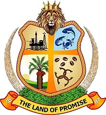
Ȯra Akwa Ibom
Ọdịdị
Ȯra Akwa Ibom
| Oge/afọ mmalite | 23 Septemba 1987 |
|---|---|
| asụsụ njieme | Bekee |
| kọntinent | Eluàlà |
| mba/obodo | Naijiria |
| isi steeti | Uyo |
| dị na ngalaba nhazi mpaghara | Naijiria |
| dị na mpaghara oge | UTC+01:00, Western European Time |
| nhazi ọnọdụ | 5°0′0″N 7°50′0″E |
| geoshape | Data:Nigeria/Akwa Ibom.map |
| ụlọ ọrụ nke onye isi gọọmentị nwere | Governor of Akwa Ibom State |
| Executive òtù | Akwa Ibom Executive Council |
| òtù omebe iwu | Akwa Ibom State House of Assembly |
| Nkwekọrịtara oke ala | Ȯha Abia, Ȯra Cross River, Rivers state |
| webụsaịtị | https://akwaibomstate.gov.ng/ |
| Koodu ọkpụkpọ obodo | +234 |
| udi maka maapụ | Category:Maps of Akwa Ibom State |

| Ȯra Akwa Ibom State nickname: Land of Promise | ||
| Location | ||
|---|---|---|

| ||
| Statistics | ||
| Governor | Udom Gabriel Emmanuel (PDP) | |
| Date Created | 23 Septemba 1987 | |
| Capital | Uyo | |
| Area | 7,081 km² Ranked 30th | |
| Population 1991 Census 2006 est. |
Ranked 15th N/A 3,920,208 | |
| ISO 3166-2 | NG-AK | |
| Website | ||
Akwa Ibom State bu state no n'ime Naigeria.
Lee nke ozo
[dezie | dezie ebe o si]
Abia ·
Adamawa ·
Akwa Ibom ·
Anambra ·
Bauchi ·
Bayelsa ·
Benue ·
Borno ·
Cross River ·
Delta ·
Ebonyi ·
Edo ·
Ekiti ·
Enugu ·
Gombe ·
Imo ·
Jigawa ·
Kaduna ·
Kano ·
Katsina ·
Kebbi ·
Kogi ·
Kwara ·
Lagos ·
Nasarawa ·
Niger ·
Ogun ·
Ondo ·
Osun ·
Ọyọ ·
Plateau ·
Rivers ·
Sokoto ·
Taraba ·
Yobe ·
Zamfara
Federal Capital Territory (FCT):
Abuja

